


contattaci
Mt. Parnassos is not only a ski centre; it is also a National Park, with a wealth of forest roads, beautiful villages, unknown monasteries and excellent footpaths crossing wonderful landscapes.
You will find all this and more marked accurately and clearly on the ROAD map of Mt. Parnassos.
The ROAD map of Mt. Parnassos contains the following features, as do all ROAD mountain maps:
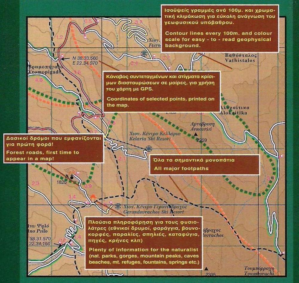
*Precision geophysical background provided by the Hellenic Military Geographic Service, to which we have added shades of brown to provide you with a 'relief' and clear image of the mountain masses. The contour lines of this map are at 100m intervals. This map features the most complete road network to appear on a map of Mt. Parnassos, including even the most insignificant secondary and blind unsurfaced roads (so that you know where not to turn!), the scenic routes are highlighted in green (telling you where you should turn!), with precision distances in kilometres from intersection to intersection, to allow you to track your course with greater ease.
*The mountain’s major footpaths are accurately positioned on the map. The booklet insert accompanying this map provides a detailed, step by step, description of the nicest hiking route on Mt. Parnassos, from Delphi to the Corycian Cave (Korykio Andro) and from there to Livadi Parnassou, an ideal route for novices and seasoned hikers alike.
*A wealth of information for nature lovers (altitudes of peaks, footpaths, mountain refuges, gorges, caves, beaches, springs, the boundaries of the National Park, and more) and travellers (archaeological sites, country churches, monasteries, castles, and more) and much practical information for drivers in general (gas stations, tire repair shops, hubs, tunnels and more).
*An insert 32-page booklet containing information (in English and Greek) about the mountain, its flora and fauna, geology, mythology, history, monasteries, villages and footpaths and, of course, an alphabetical index and a list of useful telephone numbers.