


contattaci
The Lefkada title is the perfect example of how to separate the.. men from the boys! Many maps of this beautiful Ionian island have been published, some of which by big shot cartographers. Don't bother comparing the 'details' on secondary unsurfaced roads and places to see. Go directly to the central parts and see how they have marked the main surfaced roads surrounding the tourist sites, such as Nydri, for example! Don't even take the trouble to spot the mistakes in the mapping of the roads. These mistakes are noticed after the fact (or rather during the 'fact', while travelling..) by the buyers that chose these maps because of their shiny cover or pompous cartographic technical characteristics that are written in such hard to follow language, precisely to make an impression.
Leave those maps to the less demanding users and tour Lefkada in the company of what is by far the best map of the island available. The most complete road network with analytical and precision distances in kilometres from intersection to intersection, and all the beaches and places of interests are printed in clear colours and marked with distinct symbols, on the easiest to read map available , the only one you can read without straining your eyes.
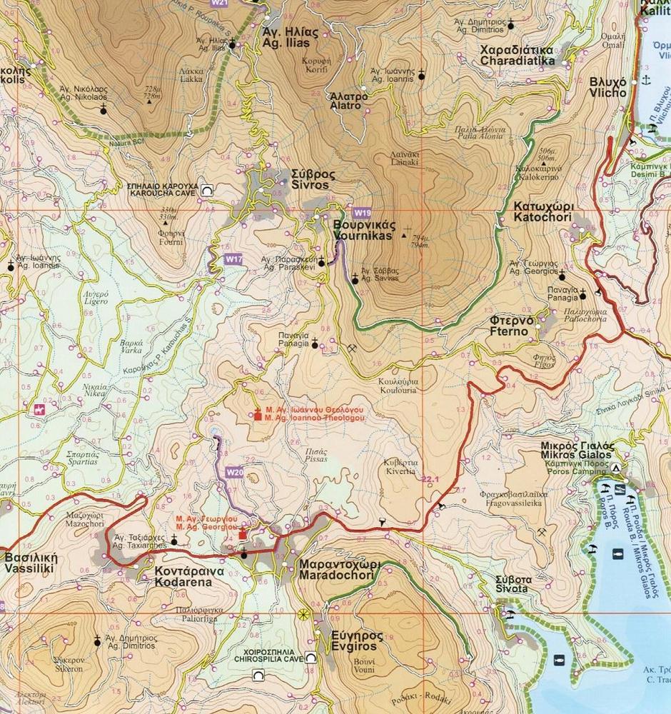
The geophysical background was provided by the Hellenic Military Geographic Service, with contour lines at 20m intervals, and a complete hydrography. See all the scenic routes, the ones worth driving your car or motorcycle on. See the castles and archaeological sites and, of course, the roads leading to them, the caves, country churches, the waterfall northwest of Nydri and many more places worth visiting.
The neighbouring Meganissi is also perfectly mapped. In this case too it is worth your while to compare ROAD's cartography with that of others to determine the amazing deficiencies and errors of the latter.
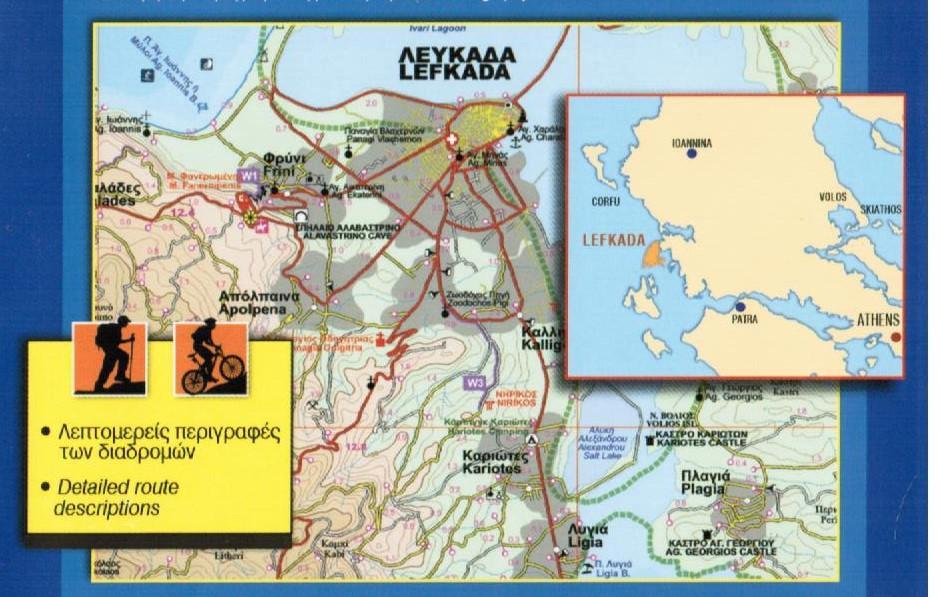
The back of the map, also in colour, boasts the best map ever published on the city of Lefkada, with all public buildings and services, pedestrian walks, the marina, the points of entry and exit, churches, museums, banks, car and motorbike rental offices, hotels, restaurants , even the bars!
On the back of the map there is also a helpful and easy to read table of dates that mark the island’s history, a table containing interesting geographic data and, of course, a complete listing of all the accommodations on the island.