


contattaci

Annapurna region at 1:100,000 in a series of detailed topographic maps of selected trekking areas of Nepal originally prepared by E. Schneider and now edited by the German Scientific Association of Comparative High-Mountain Research (Arbeitsgemeinschaft für vergleichende Hochgebirgsforschung). The map covers the whole of the Annapurna Circuit, extending from Pokhara to Muktinath and Jomosom. Contours are at 100m intervals. An overprint highlights the route of the Annapurna Circuit, but no other tourist information is provided. The map has 10-km UTM crosshairs, plus margin ticks for latitude and longitude at 15’. Map legend is in English. Current edition of this map was published in 2005.
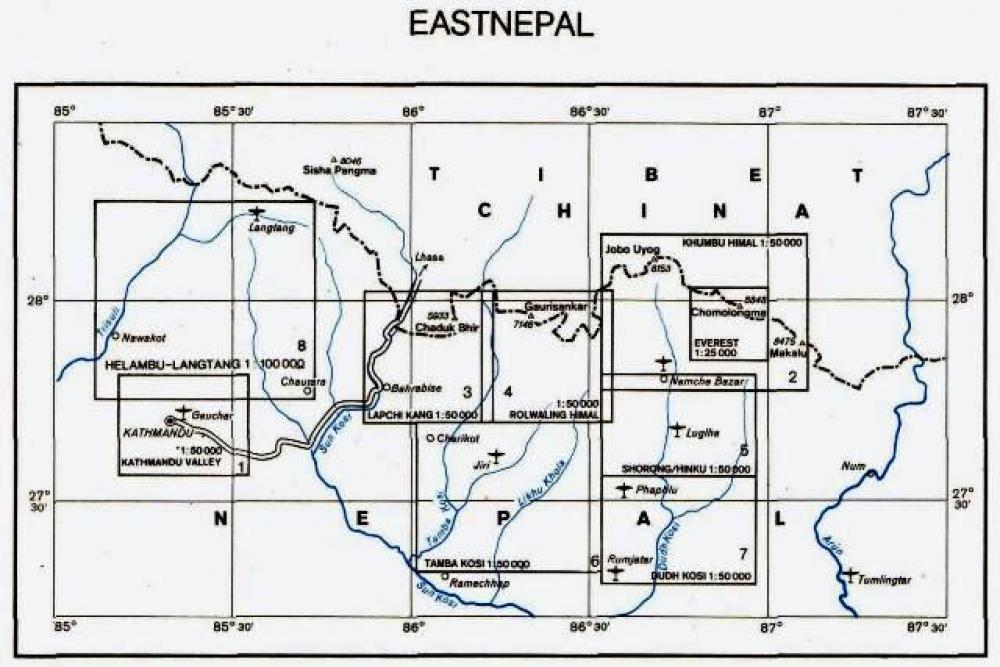
Traditionally referred to as “the Schneider maps”, titles in this series cover Nepal’s most popular trekking regions at 1:50,000 or 1:100,000. The maps were originally prepared by the Austrian climber and cartographer Erwin Schneider and for nearly five decades provided the best and often the only coverage of these areas. Now sponsored by the German Scientific Association of Comparative High-Mountain Research (Arbeitsgemeinschaft für vergleichende Hochgebirgsforschung), the maps are still quoted in most trekking guides to Nepal. Most maps have contours at 40-m intervals and, with bold relief shading and colouring for the glaciers, provide a vivid representation of the terrain.