it
wishlist
login
mail

contattaci

Cartografia

Carte escursionistiche, carte stradali e atlanti, cartografia d'Italia e di tutto il mondo. Carte dei sentieri, cartografia per il cicloturismo e mountain bike

Montagna

Guide alpinistiche, guide escursionistiche, manuali tecnici per l'alpinismo estivo ed invernale. Letteratura e filmografia di montagna

Mare

Manuali nautici, cartografia nautica, libri e letteratura per la barca a vela e motore

Viaggi

Guide turistiche per viaggi e letteratura di viaggio per l'Italia, l'Europa e tutto il Mondo

Militaria

Raccolta delle migliori pubblicazioni (libri e dvd) sulla guerra in montagna sulle Alpi e sul resto d'Italia e d'Europa
indietro
Norvegia
Kummerly & Frey | carte stradali e atlanti | Svizzera | 13 x 25 | 1:800.000 - 1:900.000

Norvegia

1:800.000 - 1:900.000

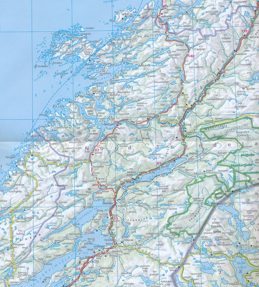
Large, indexed map of Norway, presenting the whole country in two panels side by side. 

Clear, well-presented cartography has fine relief shading and spot heights to indicate the topography, with national parks prominently marked. Detailed presentation of the road network includes scenic routes, roads closed to traffic, seasonal closures of mountain passes, etc. Towns and places of particular interest are highlighted. The map has a latitude/longitude grid at intervals of 1º. Map legend includes English.

The map also has an enlargement for the environs of Oslo and an inset showing Svalbard. An index of place names is attached to the map cover. North of Lillehammer coverage extends to include the neighbouring areas of Sweden and northern Finland.

aggiungi alla lista dei desideri
€ 13.50
quantità
- 1 +
spedizione :: Italia
Corriere espresso € 6.00
disponibilità
mediamente spedito in 15/30 giorni
Aggiungi al carrello