


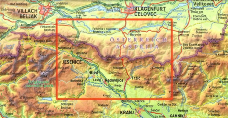
Karavanke Mountains between the peaks of Kepe and Košutenikov Turn at 1:50,000 on a waterproof and tear-resistant, contoured and GPS compatible walking and cycling map from Kartografija in Ljubljana, with on the reverse information about local mountain huts.
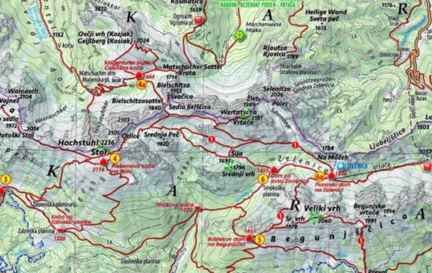
Coverage, including the overprint for hiking trails, cycle routes and other tourist information, spans both sides of the Slovenia / Austria border. On the reverse are map extracts centred on 20 huts specially highlighted on the main map, each with GPS coordinates, seasonal opening dates and contact details, plus a photo.
Maps in this series have contours at 20m intervals, enhanced by relief shading, with plenty of spot heights and names of peaks, mountain chains, etc. Local hiking routes are highlighted, indicating difficult passages. Also marked are recommended cycling routes. Symbols indicate various types of accommodation including mountain huts, campsites, inns with lodgings, tourist farms or apartments, hotels and motels, as well as recreational facilities (golf, horse riding, swimming pools, etc), vineries, cultural and historical sites, etc. Road network indicates locations of petrol stations. Railway lines are shown with stations and various types of mountain transport (gondolas, chair lifts, etc) are marked. The maps have a latitude and longitude grid at intervals of 2’’.