


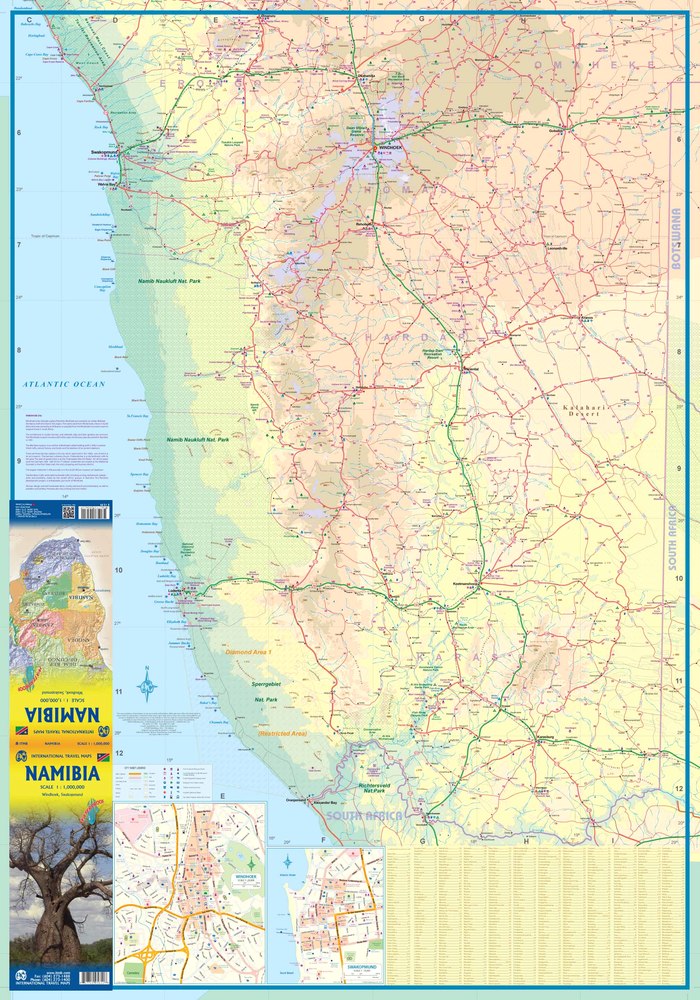
The Namibia Travel Map has been re-worked by the publishers to a better scale than was available before, and is now a double-sided map. As a result the map of this lightly-populated country, is much easier to read. There are inset maps of the two major cities of Swakopmund and Windhoek, and an emphasis on the Etosha Pan area. The map shows: Roads by classification, Provincial Boundaries, Capital, City, Town and Small Town, Village, Airport, Points of Interest, Ports, Campsite, Ruins, Museums, Hot Springs, National Parks, Medical Facilities, View Points, and Border Crossings.