


Road Atlas of Iceland at 1:500,000 from Ferðakort, published in a handy 15x25cm spiral-bound format, with an index of over 3,000 entries, a comprehensive distance table, 46 street plans including Reykjavik and several thematic map sincluding cultural heritage and geology.
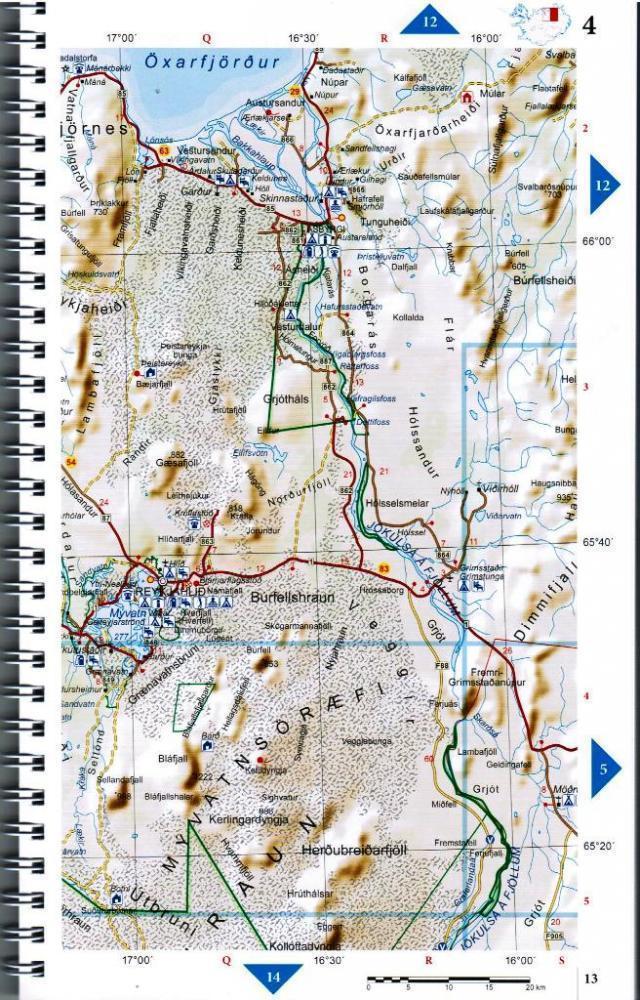
The whole of Iceland is covered at 1:500,000 with the road network distinguishing between paved and gravel roads, and showing which small local roads are maintained by the country’s government. Fords, locations of petrol stations, driving distances and car ferry routes are marked. National parks and other protected areas are highlighted and symbols mark locations of various places of interest: different types of tourist accommodations including campsites, refuges and emergency shelters, museums and cultural centres, sport and recreational facilities, local airfields, hydro-electric and thermal power stations, etc. The maps have relief shading with spot heights and plenty of names of various geographical features. Lava fields and glaciers are shown and hot springs are prominently marked. The maps have latitude and longitude lines at intervals of 20’ and 30’ respectively. Comprehensive index of over 3,000 place names includes geographical features such as mountain ranges, volcanoes, etc.
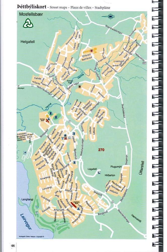
The atlas includes street plans of 46 towns, highlighting places of interest and various facilities; Reykjavik is covered on 10 pages with an additional enlargement for the town centre. Also provided are a comprehensive distance table and several thematic maps: protected natural areas, historical heritage, orientation table for viewing the surrounding landscape, administrative divisions, radio reception areas, geology, and vegetation, etc. Map legend and all the text include English.