


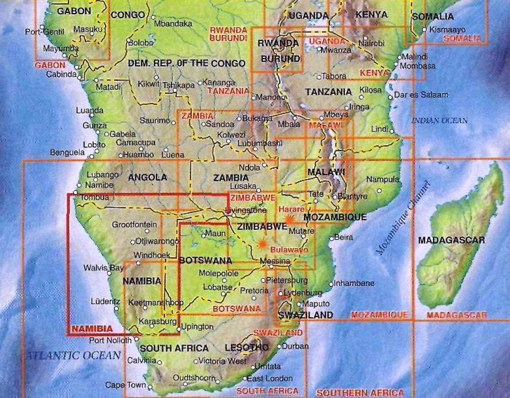
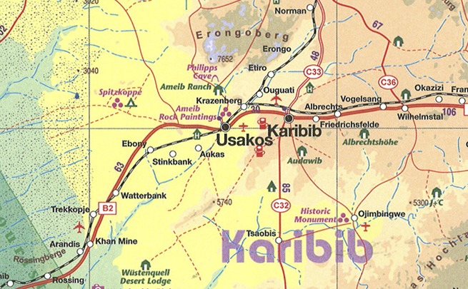
Folded, indexed road and travel map. Distinguishes roads ranging from highways to tracks (seasonal). Legend includes points of interest, internet cafes, restricted access roads, railroads, international/domestic airports, aerodromes, lodging, rest houses, guest farms, campsites, ruins historic/archaeological), museums, vistas, hot springs, caves, forts, shipwrecks, gas stations, medical facilities, missions, national parks/reserves, salt pans, restricted areas, sand dunes, cliffs, passes. Includes inset map of Windhoek and Swakopmund. The former German colony and mandated territory of South-west Africa has emerged as a major touristic destination. Following our recent research trip to the country, we have made numerous changes to the map - upgrading roads that have been paved, changing our Caprivi Strip information, and re-doing our inset map of Windhoek.
City plan: Swakopmund, Windhoek