it
wishlist
login
mail

contattaci

Cartografia

Carte escursionistiche, carte stradali e atlanti, cartografia d'Italia e di tutto il mondo. Carte dei sentieri, cartografia per il cicloturismo e mountain bike

Montagna

Guide alpinistiche, guide escursionistiche, manuali tecnici per l'alpinismo estivo ed invernale. Letteratura e filmografia di montagna

Mare

Manuali nautici, cartografia nautica, libri e letteratura per la barca a vela e motore

Viaggi

Guide turistiche per viaggi e letteratura di viaggio per l'Italia, l'Europa e tutto il Mondo

Militaria

Raccolta delle migliori pubblicazioni (libri e dvd) sulla guerra in montagna sulle Alpi e sul resto d'Italia e d'Europa
ricerca avanzata ricerca avanzata
indietro
Calcutta & India nord-est
ITMB | Carte stradali | Vancouver | 2008 | 10 x 25 | 1:2.300.000 + 1:10.000

Calcutta & India nord-est

1:2.300.000 + 1:10.000

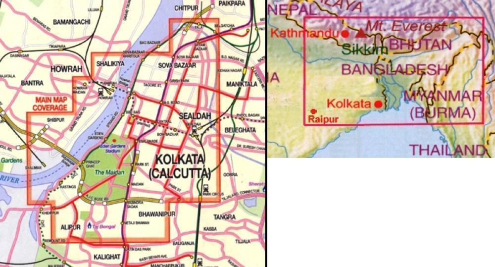
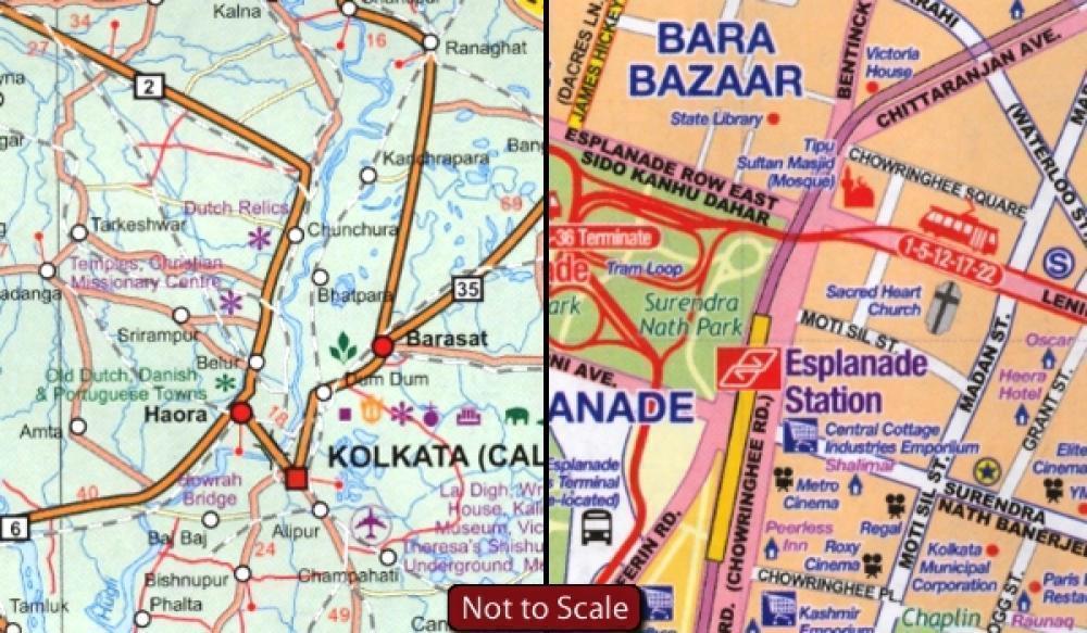
This is the first map published of Calcutta, the historic city at the mouth of the famous Hooghly River. I spent a week in Calcutta many moons ago and retain vivid memories of the city that is the essence of the passion that drives India. Now re-named Kolkata, this detailed city map shows the Howrah railway station, the exotic Burra Bazaar, Fort William, the Queen Victoria Gardens, the zoo, the Chowringhee and Esplanade hotel and entertainment sections, and the Sudder Street backpacker area of cheap hotels. The other side of the map shows the entire north eastern segment of the country from Varanasi (Benares) and Raipur in the west to the temple city of Bhubaneshwar in the south and the Nepalese/Chinese/Burmese borders in the north and east; truly a marvellous map of a part of the world that has not received much coverage up to now; printed double-sided on paper.
 
aggiungi alla lista dei desideri
€ 11.00
quantità
- 1 +
spedizione :: Italia
Corriere espresso € 5.50
disponibilità
immediata - spedito entro 24/48 ore
Aggiungi al carrello