


Japan at 1:1,100,000 from ITMB on a double-sided, indexed road map printed on light, waterproof and tear-resistant plastic paper, with enlargements showing the environs of Tokyo, Kyoto - Nara and Osaka in greater detail.
The map divides the country north-south along the Honshu Island with a good overlap between the two sides and a separate index for each side. Numerous insets on the southern half show Okinawa, Oshima and other offshore islands.
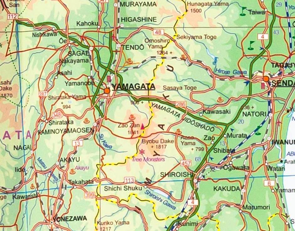
Altitude tinting and spot heights, plus names of peaks and mountain ranges convey the general relief. Road information includes secondary roads and distinguishes highways with and without tolls. Intermediate driving distances are indicated on main routes. Railways identify the Shinkansen route, and major ferry routes between the islands are marked. The map also shows the country’s internal administrative boundaries with names of the provinces. Symbols indicate various places of interest including national parks and protected areas, temples and shrines, beaches, etc. Latitude & longitude lines are at 1° intervals. Map legend is in English and Japanese.
Three large insets show the environs of Tokyo, Kyoto - Nara and Osaka in greater detail, including access to the Narita and Kansai international airports.
