


National Geographic's Ireland Adventure Map is designed to meet the unique needs of adventure travelers—detailed, durable, and accurate. Ireland includes the locations of thousands of major cities and towns with an index for easily locating them, plus a clearly marked road network complete with distances and designations for major highways, limited access highways and more.
What sets National Geographic Adventure Maps apart from traditional road maps are the hundreds of points-of-interest that highlight the diverse, unique, and exotic destinations within Ireland including national parks and preserves, World Heritage sites, castles, archeological sites, monuments, scenic viewpoints, beaches, natural points of interest, and important travel aids like airports, airstrips, rail lines, ferry routes, lighthouses, and harbors.
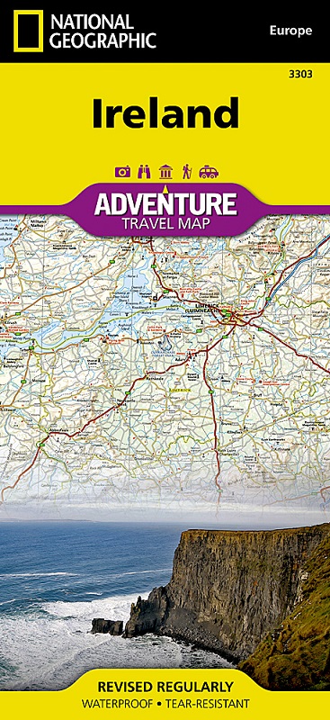
The north side of the Ireland map details from the northernmost tip of the island at Malin Head south to Dublin and Galway, including Belfast, Dundalk, Londonderry, and Sligo. The south side overlaps the northern side of the map at Galway on the west and Dublin on east, covering the remainder of the country including the cities of Limerick, Tralee, Cork, and Waterford. An inset map provides detail of the Skellig Islands. Sites of interest from prehistoric monuments and castles to churches and abbeys are noted making this map indispensable for the traveler seeking to explore Ireland’s rich history.
Popular places included on the map: Connemara Countryside, Cliffs of Moher, The Burren, Blarney Castle and the Blarney Stone, Lakes of Killarney, Giant’s Causeway, Hill of Tara, and Trim Castle.
