


Double-sided map of Nova Scotia with Price Edward Island, part of a series of maps of Canadian provinces from the Vancouver-based ITMB, with topography presented by altitude colouring rather than by relief shading, with spot heights in feet.
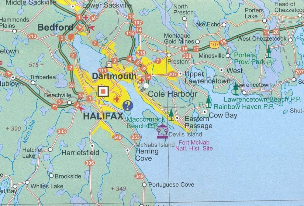
The map divides Nova Scotia north/south, with a generous overlap between the sides. Roads, railways and ferry connections are shown, with locations of visitors centres prominently highlighted. Other symbols mark national and provincial parks or protected areas, historic sites and museums, ski areas, etc. The map has a latitude and longitude grid at intervals of 30’ and an index of localities.
Also included are street plans of central Halifax and Sydney.
