en
wishlist
login
mail

contact us

Cartography

Hiking maps, maps and atlases, cartography around the world. Maps of the trails, cartography for cyclotourism and mountain biking

Mountain

Alpine guides, hiking guides, technical manuals for summer and winter mountaineering. Mountain literature and filmography

Sea

Nautical manuals, nautical cartography, books and literature for sailboat and motor

Travels

Travel guides and travel literature for Italy, Europe and the rest of the world

Military

Collection of the best publications (books and DVDs) on the mountain war on the Alps and the rest of Italy and Europe
advanced search ricerca avanzata
back
Glacier / Waterton Lakes National Parks (Montana, Alberta) stato
National Geographic | Trails Illustrated Map | USA | impermeabile, antistrappo | 1:100.000

Glacier / Waterton Lakes National Parks (Montana, Alberta)

1:100.000

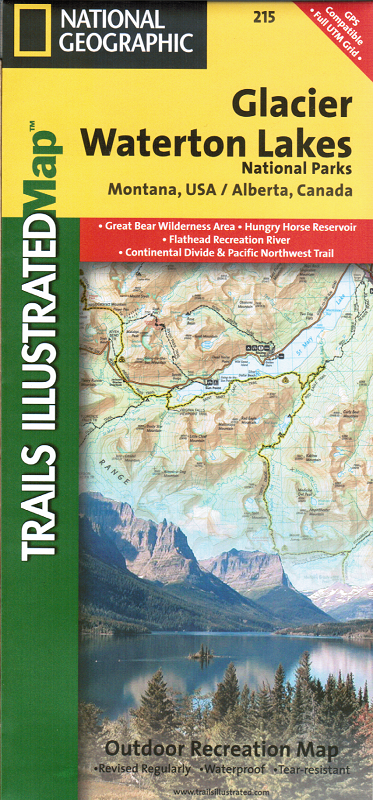
Waterton Lakes NP includes Waterton Park, Upper and Middle Waterton Lakes, The Border Ranges, Akamina Kishinena Provincial Park, Blood Timber Reserve, and more.

Glacier National Park covers the entire national park area, with detailed trails, and topographic information. Includes the Lewis and Clark Range, Many Glacier, Lake McDonald, Great Bear Wilderness, Flathead National Forest, Columbia Falls, Horse Reservoir, St. Mary Lake, and much more. UTM grids for use with your GPS unit are also provided.

add to wish list
€ 15.00
quantity
- 1 +
ship to :: Italia
Corriere espresso € 5.50
availability
out of stock