


Boston street plan and on the reverse a road map of the north-eastern seaboard of USA between Philadelphia and the Canadian border, both indexed, on a double-sided map from ITMB printed on light, waterproof and tear-resistant synthetic paper.
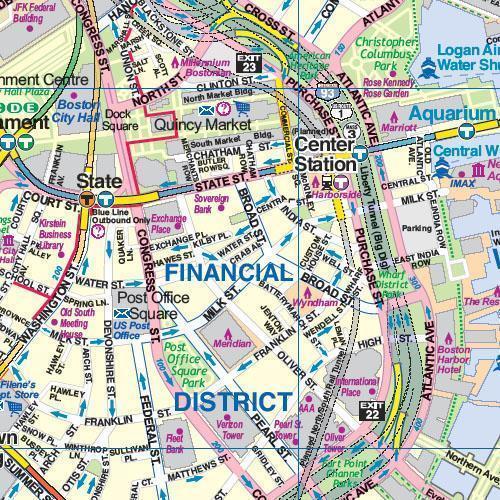
On one side is a very clear, indexed street plan at 1:10,000 of Boston’s central districts, extending across the Charles River to include Cambridge, with the Harvard University Campus in the north-western corner of the map. In the east coverage includes the Logan International Airport with road and water shuttle access to it. MBTA transit, subway and Silver Line Bus-Way routes are clearly marked, and the whole system is also shown on a separate diagram. For drivers the plan highlights main traffic arteries and indicates one way streets. Symbols mark numerous places of interest, including locations of several hotels. Also provided is a small road map of the city’s environs.
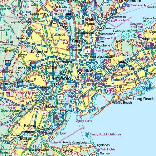
On the reverse is an indexed road map at 1:1,000,000 showing the north-eastern coast between Philadelphia and the Canadian border, extending within the New York State to Syracuse (i.e. including the Adirondacks but not Niagara Falls). The map shows the region’s road network on a base with altitude colouring to present the topography, and highlights various places of interest. Insets provide a street plan of the Lower Manhattan (with SoHo and the East Village but not beyond them), plus a road map of a section of New York City with access to the JFK and La Guardia airports.
