


Spain's "wild coast" is one of the most popular holiday spots on the Iberian Peninsula. In contrast to the other well-known, extensively-developed tourist regions, the Costa Brava remains relatively untouched. Of course, hotel high-rises, fenced-in beaches and spaghetti junctions have appeared here as well, but among them a profusion of unexploited pristine natural landscape has survived: miles of coastal cliffs, bizarrely-formed mountains, and solitary beaches and bays with crystal-clear water.
On the Costa Brava, a wide variety of landscapes merge together. In addition to walks directly on the rugged seaboard, along coastal cliffs high above the sea or descending to sheltered bays, the inland walking trails offer densely wooded mountain ridges climbing to sub-alpine heights, sheer-faced high plateaux, surreal rock formations and verdant volcanic domes. All of this is only a stone's throw from the seashore, and within easy reach of the seaside resorts and coastal beaches.
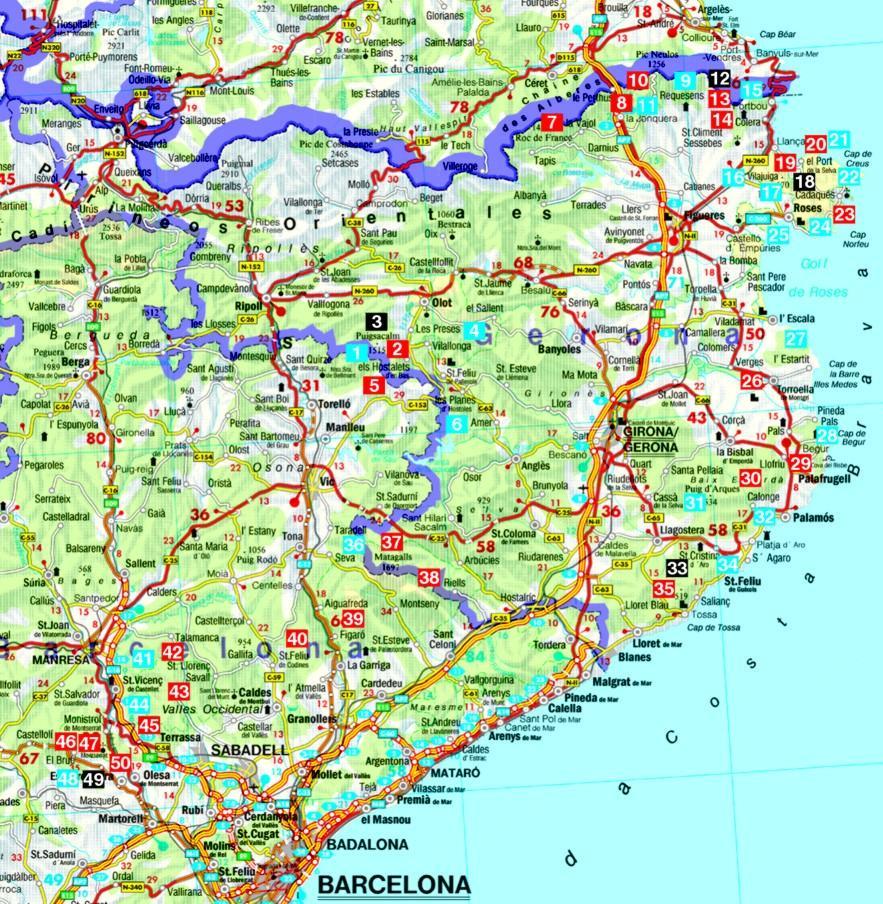
Roger Büdeler has selected 50 very diverse walks, meant to satisfy every fancy and yearning for challenge: from the leisurely "camí de ronda" on the border between land and sea to challenging summit tours, from an ecological nature trail traversing a unique swampland to a rocky route incorporating some enjoyable scrambles. With a few exceptions, the suggested routes are easy to moderately difficult and are scheduled in time frames of half a day so that ample opportunity is given for additional exploration of the natural landscapes, scenery and culture of this area.
78 photos, 50 maps in 1:25,000 / 1:50,000 / 1:75,000, 2 overview maps
