


Surinam at 1:720,000 and French Guiana at 1:500,000 from ITMB, with each country shown separately on one side of the map, indexed and accompanied by street plan(s) of central Paramaribo, Kourou and Cayenne.
Bold altitude colouring shows the topography, with elevation in feet. Swamp and mangrove areas are marked and rivers show dams, rapids or falls. The maps present each country’s road and rail networks, plus airfields for access to the remote areas of the interior. A range of symbols indicates various places of interest and tourist facilities. Also shown are internal administrative boundaries with names of the provinces, plus the disputed border zones. Each map is indexed and has latitude and longitude lines at 1° (Surinam) or 30’ (Guiana).
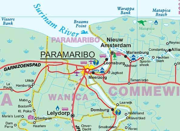
Large, clear street plans show the central areas of Paramaribo, Kourou and Cayenne, annotated with places of interest and selected accommodation. The Surinam map also Insets showing population distribution and rainfall.
